 vesseltracker.com
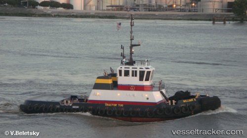
Vessel William S IMO: 1239737, MMSI: 367537450 Tug
UTC, 30.17562, -91.00626, course: 336, speed: 0
UTC, 30.18639, -91.01445, course: 52, speed: 0
2026-01-18 21:14:57 UTC, 30.20979, -91.05593, course: 285, speed: 0
Live AIS position:
UTC. Near Leblanc),
updated 2026-01-18 21:14:57 UTC.
Find the position of the vessel William S on the map. The latter are known coordinates and path.
marine traffic ship tracker show on live map
The current position of vessel William S is 30.20979 lat / -91.05593 lng. Updated: 2026-01-18 21:14:57 UTCCurrently sailing under the flag of USA
Details:
Last coordinates of the vessel:
UTC, 30.17563, -91.00627, course: 335, speed: 0UTC, 30.17562, -91.00626, course: 336, speed: 0
UTC, 30.18639, -91.01445, course: 52, speed: 0
2026-01-18 21:14:57 UTC, 30.20979, -91.05593, course: 285, speed: 0