 vesseltracker.com
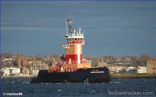
Vessel Curtis Reinauer IMO: 9653240, MMSI: 367549830 Pusher Tug
UTC, 40.64815, -74.04378, course: 102, speed: 0.3
UTC, 40.64745, -74.04361, course: 55, speed: 0
2026-03-02 16:04:46 UTC, 40.64667, -74.04167, course: -1, speed: 0
Live AIS position:
UTC. Near Tompkinsville),
updated 2026-03-02 16:04:46 UTC.
Find the position of the vessel Curtis Reinauer on the map. The latter are known coordinates and path.
marine traffic ship tracker show on live map
The current position of vessel Curtis Reinauer is 40.64667 lat / -74.04167 lng. Updated: 2026-03-02 16:04:46 UTCCurrently sailing under the flag of USA
Curtis Reinauer built in 2012 year
Deadweight:
526 tDetails:
Last coordinates of the vessel:
UTC, 40.64714, -74.04121, course: 310, speed: 0UTC, 40.64815, -74.04378, course: 102, speed: 0.3
UTC, 40.64745, -74.04361, course: 55, speed: 0
2026-03-02 16:04:46 UTC, 40.64667, -74.04167, course: -1, speed: 0