 vesseltracker.com
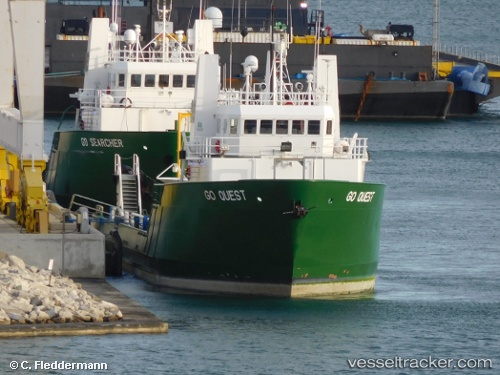
Vessel Go Quest IMO: 1155515, MMSI: 367564890 General Cargo Ship
UTC, 29.65300, -91.12378, course: -1, speed: 0
UTC, 29.65300, -91.12378, course: -1, speed: 0
2026-03-23 06:32:52 UTC, 29.65300, -91.12378, course: -1, speed: 0
Live Vessel Go Quest Analytics (details, animations, etc.)
Live AIS position: UTC. Near AMELIA), updated 2026-03-23 06:32:52 UTC.Find the position of the vessel Go Quest on the map. The latter are known coordinates and path.
marine traffic ship tracker show on live map
The current position of vessel Go Quest is 29.65300 lat / -91.12378 lng. Updated: 2026-03-23 06:32:52 UTCCurrently sailing under the flag of USA
Details:
Last coordinates of the vessel:
UTC, 29.65300, -91.12378, course: -1, speed: 0UTC, 29.65300, -91.12378, course: -1, speed: 0
UTC, 29.65300, -91.12378, course: -1, speed: 0
2026-03-23 06:32:52 UTC, 29.65300, -91.12378, course: -1, speed: 0