 vesseltracker.com
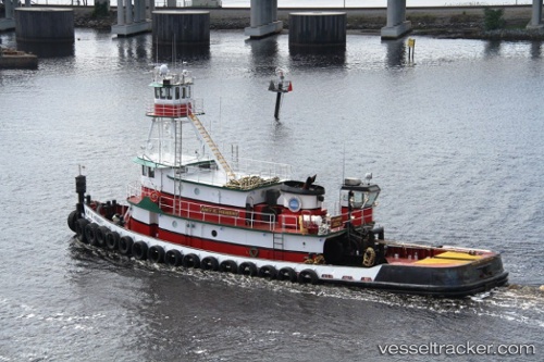
Vessel Amy E Hebert IMO: 7047667, MMSI: 367640860 Tug
UTC, 26.07502, -80.11651, course: 353, speed: 0
UTC, 26.07472, -80.11752, course: 357, speed: 0
2026-01-29 14:22:25 UTC, 26.07461, -80.11754, course: 1, speed: 0
Live AIS position:
UTC. Near Port Laudania),
updated 2026-01-29 14:22:25 UTC.
Find the position of the vessel Amy E Hebert on the map. The latter are known coordinates and path.
marine traffic ship tracker show on live map
The current position of vessel Amy E Hebert is 26.07461 lat / -80.11754 lng. Updated: 2026-01-29 14:22:25 UTCCurrently sailing under the flag of USA
Amy E Hebert built in 1969 year
Details:
Last coordinates of the vessel:
UTC, 26.07502, -80.11644, course: 353, speed: 0UTC, 26.07502, -80.11651, course: 353, speed: 0
UTC, 26.07472, -80.11752, course: 357, speed: 0
2026-01-29 14:22:25 UTC, 26.07461, -80.11754, course: 1, speed: 0