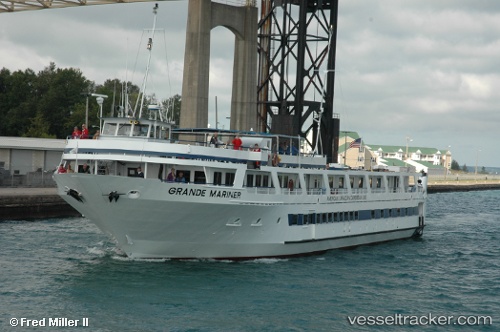
vessel Grande Mariner IMO: 8978643, Cruise Ship
vesseltracker.com
Vessel Grande Mariner IMO: 8978643, Cruise Ship
MMSI: 369024000 callsign: WCY6594 size: 13x56

Find the position of the vessel Grande Mariner on the map. The latter are known coordinates and path.

marine traffic ship tracker show on live map

The current position of vessel Grande Mariner is 40.7092 lat / -73.9855 lng. Updated: 2025-05-30 20:47:24 UTC
Payload_mass:
409 tonne
Gross tonnage:
829
Service entry:
1998-01-01T00:00:00Z
Details:


Last coordinates of the vessel:
UTC, 40.5664, -73.9723, course: -1, speed: 10.4
UTC, 40.6714, -74.0214, course: -1, speed: 10.2
UTC, 40.7093, -73.9857, course: -1, speed: 0
2025-05-30 20:47:24 UTC, 40.7092, -73.9855, course: -1, speed: 0.2

Track of the vessel in the last 14 days


Most frequent ports a vessels calls at Grande Mariner (369024000):

Tompkinsville, traffic: 8
Bayonne, traffic: 8
Brooklyn, traffic: 8
New York, traffic: 7
Hoboken, traffic: 7
Jersey City, traffic: 7
Newark, traffic: 3
Port Newark, traffic: 3
Newport, traffic: 1

Link to the map:


Find another ship

Grande_Mariner (369024000) last ports (portcalls and passsages)

Bayonne | 2025-05-30 18:41:42
Port Newark | 2025-05-16 17:38:59
Bayonne | 2025-05-16 16:53:03
Port Newark | 2025-05-04 03:27:04
Brooklyn | 2025-05-03 21:13:53
Tompkinsville | 2025-05-03 20:04:17
Port Newark | 2025-04-23 22:42:33
New York | 2025-04-23 18:18:09
Tompkinsville | 2025-04-23 17:06:20
Jersey City | 2025-04-19 14:50:06
Tompkinsville | 2025-04-19 14:16:09
Bayonne | 2025-03-27 16:49:57
Tompkinsville | 2024-10-14 22:19:08
Bayonne | 2024-09-17 08:14:18
Tompkinsville | 2024-09-17 06:56:30
Newport | 2024-02-17 04:03:35