 vesseltracker.com
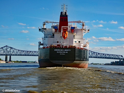
Vessel American Liberty IMO: 9763851, MMSI: 369043000 Chemical Oil Products Tanker
UTC, 27.91475, -82.44269, course: 334, speed: 0
UTC, 27.91476, -82.44274, course: -1, speed: 0
2026-03-04 03:24:49 UTC, 27.91333, -82.44167, course: -1, speed: 0
Live AIS position:
UTC. Near Tampa),
updated 2026-03-04 03:24:49 UTC.
Find the position of the vessel American Liberty on the map. The latter are known coordinates and path.
marine traffic ship tracker show on live map
The current position of vessel American Liberty is 27.91333 lat / -82.44167 lng. Updated: 2026-03-04 03:24:49 UTCCurrently sailing under the flag of USA
Details:
Last coordinates of the vessel:
UTC, 27.91476, -82.44269, course: 334, speed: 0UTC, 27.91475, -82.44269, course: 334, speed: 0
UTC, 27.91476, -82.44274, course: -1, speed: 0
2026-03-04 03:24:49 UTC, 27.91333, -82.44167, course: -1, speed: 0