 vesseltracker.com
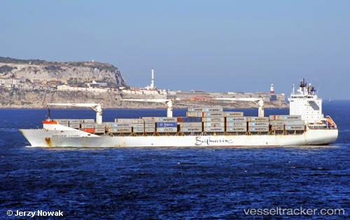
Vessel Maersk Saratoga IMO: 9289207, MMSI: 369096000 Container Ship
UTC, 2.02453, 45.33812, course: 67, speed: 0
UTC, 2.02456, 45.33812, course: 68, speed: 0
2026-01-16 20:51:54 UTC, 2.02454, 45.33810, course: 68, speed: 0
Live AIS position:
UTC. Near Mogadishu),
updated 2026-01-16 20:51:54 UTC.
Find the position of the vessel Maersk Saratoga on the map. The latter are known coordinates and path.
marine traffic ship tracker show on live map
The current position of vessel Maersk Saratoga is 2.02454 lat / 45.33810 lng. Updated: 2026-01-16 20:51:54 UTCCurrently sailing under the flag of USA
Maersk Saratoga built in 2004 year
Deadweight:
28844 tDetails:
Last coordinates of the vessel:
UTC, 2.02453, 45.33811, course: 67, speed: 0UTC, 2.02453, 45.33812, course: 67, speed: 0
UTC, 2.02456, 45.33812, course: 68, speed: 0
2026-01-16 20:51:54 UTC, 2.02454, 45.33810, course: 68, speed: 0