 vesseltracker.com
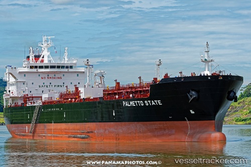
Vessel Palmetto State IMO: 9747584, MMSI: 369225000 Chemical Oil Products Tanker
UTC, 33.72800, -118.15534, course: 278, speed: 0.1
UTC, 33.72807, -118.15535, course: 272, speed: 0
2026-03-17 04:11:36 UTC, 33.72671, -118.15735, course: 14, speed: 0.1
Live Vessel Palmetto State Analytics (details, animations, etc.)
Live AIS position: UTC. Near Long Beach), updated 2026-03-17 04:11:36 UTC.Find the position of the vessel Palmetto State on the map. The latter are known coordinates and path.
marine traffic ship tracker show on live map
The current position of vessel Palmetto State is 33.72671 lat / -118.15735 lng. Updated: 2026-03-17 04:11:36 UTCCurrently sailing under the flag of USA
Details:
Last coordinates of the vessel:
UTC, 33.72828, -118.15529, course: 262, speed: 0UTC, 33.72800, -118.15534, course: 278, speed: 0.1
UTC, 33.72807, -118.15535, course: 272, speed: 0
2026-03-17 04:11:36 UTC, 33.72671, -118.15735, course: 14, speed: 0.1