 vesseltracker.com
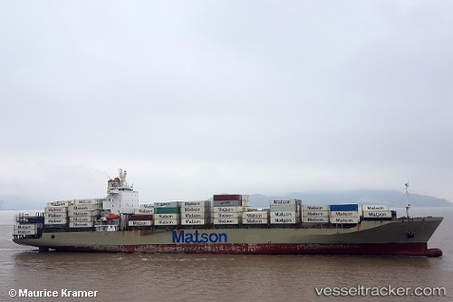
Vessel Manukai IMO: 9244130, MMSI: 369296000 Container Ship
UTC, 33.76964, -118.21754, course: 244, speed: 0
UTC, 33.76961, -118.21760, course: 244, speed: 0
2026-03-17 04:13:53 UTC, 33.76963, -118.21753, course: 244, speed: 0
Live Vessel Manukai Analytics (details, animations, etc.)
Live AIS position: UTC. Near Long Beach), updated 2026-03-17 04:13:53 UTC.Find the position of the vessel Manukai on the map. The latter are known coordinates and path.
marine traffic ship tracker show on live map
The current position of vessel Manukai is 33.76963 lat / -118.21753 lng. Updated: 2026-03-17 04:13:53 UTCDetails:
Last coordinates of the vessel:
UTC, 33.76833, -118.21667, course: -1, speed: 0UTC, 33.76964, -118.21754, course: 244, speed: 0
UTC, 33.76961, -118.21760, course: 244, speed: 0
2026-03-17 04:13:53 UTC, 33.76963, -118.21753, course: 244, speed: 0