 vesseltracker.com
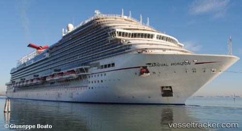
Vessel Carnival Horizon IMO: 9767091, MMSI: 370039000 Cruise Ship
UTC, 15.69642, -72.59164, course: 137, speed: 16.4
UTC, 15.52500, -72.45667, course: -1, speed: 16
2026-01-19 22:21:20 UTC, 15.09683, -72.12079, course: 137, speed: 16.3
Live AIS position:
UTC. 171 nm N of PUERTO BOLIVAR),
updated 2026-01-19 22:21:20 UTC.
Find the position of the vessel Carnival Horizon on the map. The latter are known coordinates and path.
marine traffic ship tracker show on live map
The current position of vessel Carnival Horizon is 15.09683 lat / -72.12079 lng. Updated: 2026-01-19 22:21:20 UTCCurrently sailing under the flag of Panama
Details:
Last coordinates of the vessel:
UTC, 15.89500, -72.74667, course: -1, speed: 16UTC, 15.69642, -72.59164, course: 137, speed: 16.4
UTC, 15.52500, -72.45667, course: -1, speed: 16
2026-01-19 22:21:20 UTC, 15.09683, -72.12079, course: 137, speed: 16.3