 vesseltracker.com
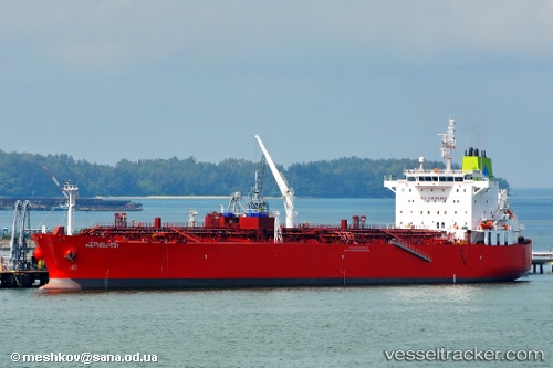
Vessel GULF HUWAYLAT IMO: 9359870, MMSI: 370211000 Oil/Chemical Tanker
UTC, 30.04117, -90.68343, course: 243, speed: 1.8
UTC, 30.04142, -90.68500, course: 238, speed: 0
2026-03-14 17:26:57 UTC, 30.04138, -90.68498, course: -1, speed: 0
Live Vessel GULF HUWAYLAT Analytics (details, animations, etc.)
Live AIS position: UTC. Near LUTCHER), updated 2026-03-14 17:26:57 UTC.Find the position of the vessel GULF HUWAYLAT on the map. The latter are known coordinates and path.
marine traffic ship tracker show on live map
The current position of vessel GULF HUWAYLAT is 30.04138 lat / -90.68498 lng. Updated: 2026-03-14 17:26:57 UTCCurrently sailing under the flag of Panama
Details:
Last coordinates of the vessel:
UTC, 29.99570, -90.43973, course: 270, speed: 9.6UTC, 30.04117, -90.68343, course: 243, speed: 1.8
UTC, 30.04142, -90.68500, course: 238, speed: 0
2026-03-14 17:26:57 UTC, 30.04138, -90.68498, course: -1, speed: 0