 vesseltracker.com
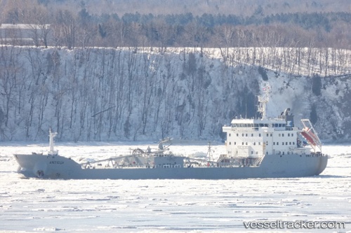
Vessel Antigua IMO: 9512587, MMSI: 370424000 Cement Carrier
UTC, 41.52328, 31.90570, course: 89, speed: 0
UTC, 41.52327, 31.90572, course: 89, speed: 0
2026-02-24 04:03:51 UTC, 41.52325, 31.90569, course: 89, speed: 0
Live AIS position:
UTC. Near EREN),
updated 2026-02-24 04:03:51 UTC.
Find the position of the vessel Antigua on the map. The latter are known coordinates and path.
marine traffic ship tracker show on live map
The current position of vessel Antigua is 41.52325 lat / 31.90569 lng. Updated: 2026-02-24 04:03:51 UTCCurrently sailing under the flag of Panama
Antigua built in 2012 year
Deadweight:
16800 tDetails:
Last coordinates of the vessel:
UTC, 41.52325, 31.90570, course: 89, speed: 0UTC, 41.52328, 31.90570, course: 89, speed: 0
UTC, 41.52327, 31.90572, course: 89, speed: 0
2026-02-24 04:03:51 UTC, 41.52325, 31.90569, course: 89, speed: 0