 vesseltracker.com
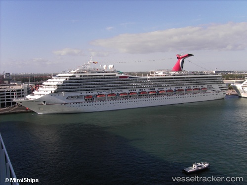
Vessel Carnival Freedom IMO: 9333149, MMSI: 371154000 Cruise Ship
UTC, 27.60500, -78.46167, course: -1, speed: 9
UTC, 27.53135, -78.26285, course: 109, speed: 9
2026-01-18 12:11:31 UTC, 27.39833, -77.90667, course: -1, speed: 10
Live AIS position:
UTC. 50 nm NW of Green Turtle Cay),
updated 2026-01-18 12:11:31 UTC.
Find the position of the vessel Carnival Freedom on the map. The latter are known coordinates and path.
marine traffic ship tracker show on live map
The current position of vessel Carnival Freedom is 27.39833 lat / -77.90667 lng. Updated: 2026-01-18 12:11:31 UTCCurrently sailing under the flag of Panama
Carnival Freedom built in 2007 year
Deadweight:
12870 tDetails:
Last coordinates of the vessel:
UTC, 27.67667, -78.65500, course: -1, speed: 10UTC, 27.60500, -78.46167, course: -1, speed: 9
UTC, 27.53135, -78.26285, course: 109, speed: 9
2026-01-18 12:11:31 UTC, 27.39833, -77.90667, course: -1, speed: 10