 vesseltracker.com
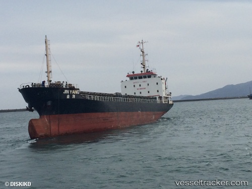
Vessel Jin Yang IMO: 9458676, MMSI: 371170000 General Cargo Ship
UTC, 33.96373, 130.96150, course: -1, speed: 13.5
UTC, 33.96373, 130.96150, course: -1, speed: 13.5
2026-03-02 05:15:02 UTC, 33.96373, 130.96150, course: -1, speed: 13.5
Live AIS position:
UTC. Near Shimonoseki),
updated 2026-03-02 05:15:02 UTC.
Find the position of the vessel Jin Yang on the map. The latter are known coordinates and path.
marine traffic ship tracker show on live map
The current position of vessel Jin Yang is 33.96373 lat / 130.96150 lng. Updated: 2026-03-02 05:15:02 UTCDetails:
Last coordinates of the vessel:
UTC, 34.04752, 130.82915, course: -1, speed: 0.1UTC, 33.96373, 130.96150, course: -1, speed: 13.5
UTC, 33.96373, 130.96150, course: -1, speed: 13.5
2026-03-02 05:15:02 UTC, 33.96373, 130.96150, course: -1, speed: 13.5