 vesseltracker.com
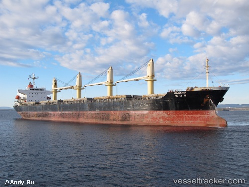
Vessel Daejoo Arirang 2 IMO: 9266138, MMSI: 371227000 Bulk Carrier
UTC, 35.83760, 129.65536, course: 182, speed: 11.5
UTC, 35.30376, 129.58089, course: 217, speed: 11.2
2026-01-31 17:37:07 UTC, 35.12092, 129.41360, course: 221, speed: 11.4
Live AIS position:
UTC. 12 nm SE of Kijang),
updated 2026-01-31 17:37:07 UTC.
Find the position of the vessel Daejoo Arirang 2 on the map. The latter are known coordinates and path.
marine traffic ship tracker show on live map
The current position of vessel Daejoo Arirang 2 is 35.12092 lat / 129.41360 lng. Updated: 2026-01-31 17:37:07 UTCDetails:
Last coordinates of the vessel:
UTC, 36.12865, 129.64040, course: 172, speed: 11UTC, 35.83760, 129.65536, course: 182, speed: 11.5
UTC, 35.30376, 129.58089, course: 217, speed: 11.2
2026-01-31 17:37:07 UTC, 35.12092, 129.41360, course: 221, speed: 11.4