 vesseltracker.com
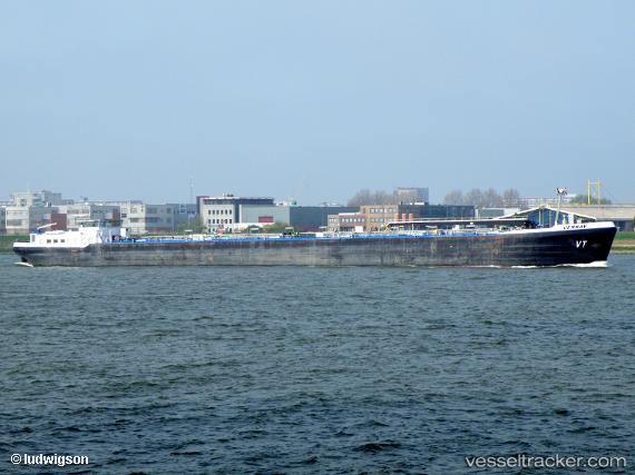
Vessel VENRAY IMO: 9568885, MMSI: 371326000 Inland Tanker
UTC, 8.81437, -79.55002, course: 11, speed: 0.1
UTC, 8.80662, -79.52388, course: 41, speed: 0.1
2026-03-09 17:43:29 UTC, 8.80671, -79.52390, course: 43, speed: 0
Live Vessel VENRAY Analytics (details, animations, etc.)
Live AIS position: UTC. Near Taboguilla), updated 2026-03-09 17:43:29 UTC.Find the position of the vessel VENRAY on the map. The latter are known coordinates and path.
marine traffic ship tracker show on live map
The current position of vessel VENRAY is 8.80671 lat / -79.52390 lng. Updated: 2026-03-09 17:43:29 UTCCurrently sailing under the flag of Panama
Details:
Last coordinates of the vessel:
UTC, 8.81469, -79.55066, course: 39, speed: 0.7UTC, 8.81437, -79.55002, course: 11, speed: 0.1
UTC, 8.80662, -79.52388, course: 41, speed: 0.1
2026-03-09 17:43:29 UTC, 8.80671, -79.52390, course: 43, speed: 0