 vesseltracker.com
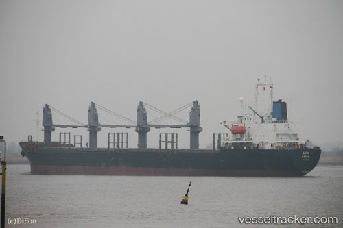
Vessel 'LILY OF SEA' IMO: 9159440, MMSI: 371485000
UTC, 6.28145, 115.61812, course: 300, speed: 9.1
UTC, 6.50613, 115.13214, course: 310, speed: 9
2026-01-28 16:18:49 UTC, 6.66006, 114.88449, course: 310, speed: 8.4
Live AIS position:
UTC. 54 nm W of Tembungo),
updated 2026-01-28 16:18:49 UTC.
Find the position of the vessel 'LILY OF SEA' on the map. The latter are known coordinates and path.
marine traffic ship tracker show on live map
The current position of vessel 'LILY OF SEA' is 6.66006 lat / 114.88449 lng. Updated: 2026-01-28 16:18:49 UTCDetails:
Last coordinates of the vessel:
UTC, 6.23824, 115.70498, course: 305, speed: 8.9UTC, 6.28145, 115.61812, course: 300, speed: 9.1
UTC, 6.50613, 115.13214, course: 310, speed: 9
2026-01-28 16:18:49 UTC, 6.66006, 114.88449, course: 310, speed: 8.4