 vesseltracker.com
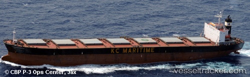
Find the position of the vessel Rya Rad on the map. The latter are known coordinates and path.
marine traffic ship tracker show on live map
The current position of vessel Rya Rad is 38.81833 lat / 118.10500 lng. Updated: 2025-11-06 12:01:46 UTCCurrently sailing under the flag of Panama
Rya Rad built in 1999 year
Deadweight:
73705 tDetails:
Last coordinates of the vessel:
UTC, 38.82151, 118.10849, course: 173, speed: 0.2UTC, 38.82085, 118.10685, course: 138, speed: 0.2
UTC, 38.81840, 118.10706, course: 23, speed: 0.1
2025-11-06 12:01:46 UTC, 38.81833, 118.10500, course: -1, speed: 0
Track of the vessel in the last 14 days
The ship also appears on the maps: