 vesseltracker.com
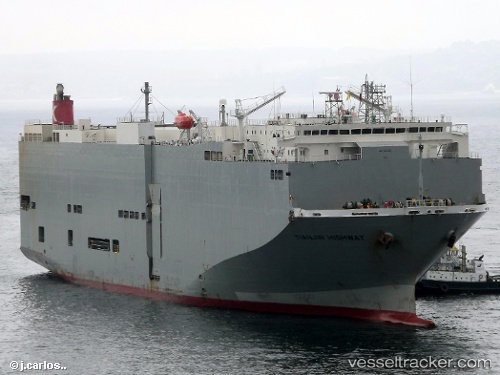
Vessel Tianjin Highway IMO: 9294355, MMSI: 371559000 Vehicles Carrier
UTC, 17.94654, -102.17325, course: 204, speed: 0
UTC, 17.94660, -102.17327, course: 204, speed: 0
2026-03-04 20:28:06 UTC, 17.94659, -102.17325, course: 204, speed: 0
Live Vessel Tianjin Highway Analytics (details, animations, etc.)
Live AIS position: UTC. Near Lazaro Cardenas), updated 2026-03-04 20:28:06 UTC.Find the position of the vessel Tianjin Highway on the map. The latter are known coordinates and path.
marine traffic ship tracker show on live map
The current position of vessel Tianjin Highway is 17.94659 lat / -102.17325 lng. Updated: 2026-03-04 20:28:06 UTCCurrently sailing under the flag of Panama
Tianjin Highway built in 2005 year
Deadweight:
15461 tDetails:
Last coordinates of the vessel:
UTC, 17.94656, -102.17327, course: 204, speed: 0UTC, 17.94654, -102.17325, course: 204, speed: 0
UTC, 17.94660, -102.17327, course: 204, speed: 0
2026-03-04 20:28:06 UTC, 17.94659, -102.17325, course: 204, speed: 0