 vesseltracker.com
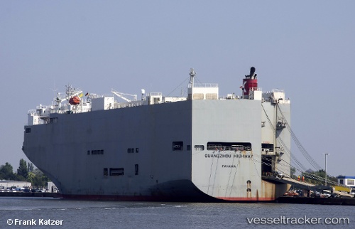
Vessel Guangzou Highway IMO: 9294367, MMSI: 371697000 Vehicles Carrier
UTC, 33.94189, 130.92851, course: 103, speed: 0
UTC, 33.94189, 130.92850, course: 103, speed: 0
2026-02-28 02:18:49 UTC, 33.94189, 130.92850, course: 103, speed: 0
Live AIS position:
UTC. Near Shimonoseki),
updated 2026-02-28 02:18:49 UTC.
Find the position of the vessel Guangzou Highway on the map. The latter are known coordinates and path.
marine traffic ship tracker show on live map
The current position of vessel Guangzou Highway is 33.94189 lat / 130.92850 lng. Updated: 2026-02-28 02:18:49 UTCDetails:
Last coordinates of the vessel:
UTC, 33.94190, 130.92851, course: 103, speed: 0UTC, 33.94189, 130.92851, course: 103, speed: 0
UTC, 33.94189, 130.92850, course: 103, speed: 0
2026-02-28 02:18:49 UTC, 33.94189, 130.92850, course: 103, speed: 0