 vesseltracker.com
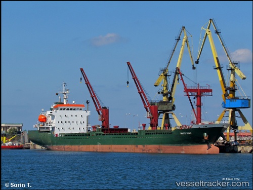
Vessel White Star IMO: 9381938, MMSI: 371702000 General Cargo Ship
UTC, 34.90568, 35.86849, course: 70, speed: 0
UTC, 34.90568, 35.86849, course: 70, speed: 0
2026-01-16 15:44:28 UTC, 34.90568, 35.86849, course: 70, speed: 0
Live AIS position:
UTC. Near Tartous),
updated 2026-01-16 15:44:28 UTC.
Find the position of the vessel White Star on the map. The latter are known coordinates and path.
marine traffic ship tracker show on live map
The current position of vessel White Star is 34.90568 lat / 35.86849 lng. Updated: 2026-01-16 15:44:28 UTCCurrently sailing under the flag of Panama
White Star built in 2007 year
Deadweight:
8447 tDetails:
Last coordinates of the vessel:
UTC, 34.90566, 35.86850, course: 70, speed: 0UTC, 34.90568, 35.86849, course: 70, speed: 0
UTC, 34.90568, 35.86849, course: 70, speed: 0
2026-01-16 15:44:28 UTC, 34.90568, 35.86849, course: 70, speed: 0