 vesseltracker.com
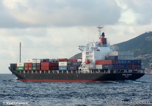
Vessel Horai Bridge IMO: 9515620, MMSI: 371791000 Container Ship
UTC, 22.33832, 114.12447, course: 73, speed: 0.6
UTC, 22.33823, 114.12442, course: 73, speed: 0.2
2026-01-29 06:01:53 UTC, 22.33832, 114.12447, course: 72, speed: 0
Live AIS position:
UTC. Near Lai Chi Kok),
updated 2026-01-29 06:01:53 UTC.
Find the position of the vessel Horai Bridge on the map. The latter are known coordinates and path.
marine traffic ship tracker show on live map
The current position of vessel Horai Bridge is 22.33832 lat / 114.12447 lng. Updated: 2026-01-29 06:01:53 UTCCurrently sailing under the flag of Panama
Horai Bridge built in 2009 year
Deadweight:
21922 tDetails:
Last coordinates of the vessel:
UTC, 22.33823, 114.12450, course: 73, speed: 0UTC, 22.33832, 114.12447, course: 73, speed: 0.6
UTC, 22.33823, 114.12442, course: 73, speed: 0.2
2026-01-29 06:01:53 UTC, 22.33832, 114.12447, course: 72, speed: 0