 vesseltracker.com
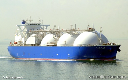
Vessel Taitar No.1 IMO: 9403669, MMSI: 371846000 Lng Tanker
UTC, 7.13702, 108.27961, course: 225, speed: 15.2
UTC, 6.81965, 107.99007, course: 214, speed: 15.6
2026-02-01 03:46:27 UTC, 6.45687, 107.72347, course: 218, speed: 15.2
Live AIS position:
UTC. 50 nm SW of Gombong),
updated 2026-02-01 03:46:27 UTC.
Find the position of the vessel Taitar No.1 on the map. The latter are known coordinates and path.
marine traffic ship tracker show on live map
The current position of vessel Taitar No.1 is 6.45687 lat / 107.72347 lng. Updated: 2026-02-01 03:46:27 UTCDetails:
Last coordinates of the vessel:
UTC, 7.48402, 108.62247, course: 225, speed: 15.6UTC, 7.13702, 108.27961, course: 225, speed: 15.2
UTC, 6.81965, 107.99007, course: 214, speed: 15.6
2026-02-01 03:46:27 UTC, 6.45687, 107.72347, course: 218, speed: 15.2