 vesseltracker.com
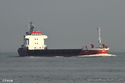
Vessel Sea King IMO: 9135858, MMSI: 372046000 General Cargo Ship
UTC, 41.29498, 29.16429, course: 6, speed: 7.7
UTC, 41.36113, 29.13452, course: 334, speed: 7.9
2026-01-16 19:26:16 UTC, 41.57111, 28.92067, course: 323, speed: 8.4
Live AIS position:
UTC. 20 nm NE of Istanbul New Airport),
updated 2026-01-16 19:26:16 UTC.
Find the position of the vessel Sea King on the map. The latter are known coordinates and path.
marine traffic ship tracker show on live map
The current position of vessel Sea King is 41.57111 lat / 28.92067 lng. Updated: 2026-01-16 19:26:16 UTCDetails:
Last coordinates of the vessel:
UTC, 41.17076, 29.07603, course: 38, speed: 7UTC, 41.29498, 29.16429, course: 6, speed: 7.7
UTC, 41.36113, 29.13452, course: 334, speed: 7.9
2026-01-16 19:26:16 UTC, 41.57111, 28.92067, course: 323, speed: 8.4