 vesseltracker.com
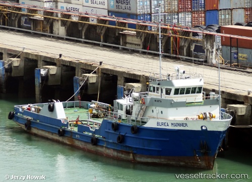
Vessel Burica Mariner IMO: 8107799, MMSI: 372113000 Offshore Tug Supply Ship
UTC, 8.90687, -79.50951, course: -1, speed: 0.2
UTC, 8.90686, -79.50992, course: -1, speed: 0.6
2026-03-01 21:35:49 UTC, 8.90677, -79.50981, course: -1, speed: 0.4
Live AIS position:
UTC. Near Panama),
updated 2026-03-01 21:35:49 UTC.
Find the position of the vessel Burica Mariner on the map. The latter are known coordinates and path.
marine traffic ship tracker show on live map
The current position of vessel Burica Mariner is 8.90677 lat / -79.50981 lng. Updated: 2026-03-01 21:35:49 UTCDetails:
Last coordinates of the vessel:
UTC, 8.90684, -79.50974, course: -1, speed: 0.7UTC, 8.90687, -79.50951, course: -1, speed: 0.2
UTC, 8.90686, -79.50992, course: -1, speed: 0.6
2026-03-01 21:35:49 UTC, 8.90677, -79.50981, course: -1, speed: 0.4