vessel Seabreeze Ii IMO: 8972273, General Cargo Ship
vesseltracker.com
Vessel Seabreeze Ii IMO: 8972273, General Cargo Ship
MMSI: 372426000 callsign: T8A2451 size: 139x17

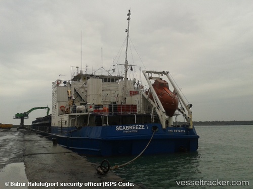
Find the position of the vessel Seabreeze Ii on the map. The latter are known coordinates and path.

marine traffic ship tracker show on live map

The current position of vessel Seabreeze Ii is 40.7237 lat / 29.4919 lng. Updated: 2024-04-19 08:45:24 UTC

Currently sailing under the flag of Panama

Seabreeze Ii built in 1988 year

Deadweight:
5354 t

Details:


Last coordinates of the vessel:
UTC, 40.7237, 29.4919, course: 156, speed: 0
2024-04-19 08:45:24 UTC, 40.7237, 29.4919, course: 157, speed: 0

Track of the vessel in the last 14 days


Most frequent ports a vessels calls at Seabreeze Ii (372426000):

Kerch, traffic: 8
Istanbul, traffic: 7
Uskudar, traffic: 5
Novorossiysk, traffic: 4
Samsun, traffic: 4
Rostov-Na-Donu, traffic: 2
Trabzon, traffic: 2
Canakkale, traffic: 2
Zonguldak, traffic: 2
Constanta, traffic: 2
Gelibolu, traffic: 2
Mitilini, traffic: 2

Link to the map:


Find another ship

Seabreeze_Ii (372426000) last ports (portcalls and passsages)

Istanbul | 2022-03-28 09:00:13
Novorossiysk | 2022-03-22 01:15:23
Samsun | 2022-03-10 21:25:00
Trabzon | 2022-02-23 03:11:15
Novorossiysk | 2022-02-19 21:45:18
Istanbul | 2022-02-12 15:57:30
Uskudar | 2022-02-12 09:30:15
Canakkale | 2022-02-11 18:20:27
Mitilini | 2022-02-06 00:48:30
Gelibolu | 2022-02-05 11:49:45
Istanbul | 2022-02-03 11:10:43
Kerch | 2022-01-24 14:00:00
Constanta | 2022-01-14 14:05:14
Kerch | 2021-12-29 08:35:12
Zonguldak | 2021-12-13 12:30:13
Kerch | 2021-12-11 12:00:15
Rostov-Na-Donu | 2021-12-07 07:23:13
Kerch | 2021-12-05 13:32:00
Samsun | 2021-12-01 00:56:00