 vesseltracker.com
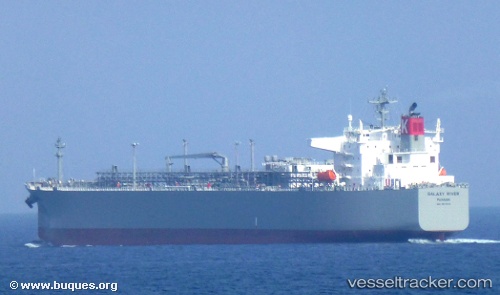
Vessel Galaxy River IMO: 9670016, MMSI: 372915000 Lpg Tanker
UTC, 51.33984, 3.76582, course: 302, speed: 0
UTC, 51.33981, 3.76581, course: 301, speed: 0
2026-02-04 21:38:24 UTC, 51.33985, 3.76580, course: 302, speed: 0
Live AIS position:
UTC. Near Hoek),
updated 2026-02-04 21:38:24 UTC.
Find the position of the vessel Galaxy River on the map. The latter are known coordinates and path.
marine traffic ship tracker show on live map
The current position of vessel Galaxy River is 51.33985 lat / 3.76580 lng. Updated: 2026-02-04 21:38:24 UTCCurrently sailing under the flag of Panama
Details:
Last coordinates of the vessel:
UTC, 51.33979, 3.76580, course: 302, speed: 0.1UTC, 51.33984, 3.76582, course: 302, speed: 0
UTC, 51.33981, 3.76581, course: 301, speed: 0
2026-02-04 21:38:24 UTC, 51.33985, 3.76580, course: 302, speed: 0