 vesseltracker.com
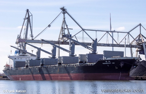
Vessel Moonbright Sw IMO: 9610195, MMSI: 373060000 Bulk Carrier
UTC, 2.28866, 101.85908, course: 306, speed: 11.5
UTC, 2.47457, 101.62956, course: 311, speed: 13.2
2026-02-03 05:27:52 UTC, 2.74332, 101.22143, course: 296, speed: 13.8
Live AIS position:
UTC. 13 nm SW of Pulau Indah),
updated 2026-02-03 05:27:52 UTC.
Find the position of the vessel Moonbright Sw on the map. The latter are known coordinates and path.
marine traffic ship tracker show on live map
The current position of vessel Moonbright Sw is 2.74332 lat / 101.22143 lng. Updated: 2026-02-03 05:27:52 UTCCurrently sailing under the flag of Panama
Moonbright Sw built in 2012 year
Deadweight:
36378 tDetails:
Last coordinates of the vessel:
UTC, 2.02232, 102.20287, course: 308, speed: 10.3UTC, 2.28866, 101.85908, course: 306, speed: 11.5
UTC, 2.47457, 101.62956, course: 311, speed: 13.2
2026-02-03 05:27:52 UTC, 2.74332, 101.22143, course: 296, speed: 13.8