 vesseltracker.com
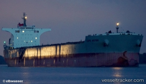
Vessel Cape Aster IMO: 9538749, MMSI: 373083000 Bulk Carrier
UTC, 51.96551, 4.11311, course: 111, speed: 0
UTC, 51.96552, 4.11314, course: 111, speed: 0
2026-02-22 13:49:39 UTC, 51.96547, 4.11312, course: 111, speed: 0
Live AIS position:
UTC. Near HOEK VAN HOLLAND),
updated 2026-02-22 13:49:39 UTC.
Find the position of the vessel Cape Aster on the map. The latter are known coordinates and path.
marine traffic ship tracker show on live map
The current position of vessel Cape Aster is 51.96547 lat / 4.11312 lng. Updated: 2026-02-22 13:49:39 UTCDetails:
Last coordinates of the vessel:
UTC, 51.96550, 4.11310, course: 111, speed: 0UTC, 51.96551, 4.11311, course: 111, speed: 0
UTC, 51.96552, 4.11314, course: 111, speed: 0
2026-02-22 13:49:39 UTC, 51.96547, 4.11312, course: 111, speed: 0