 vesseltracker.com
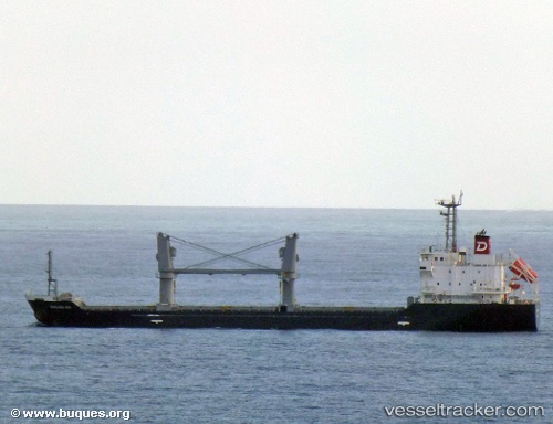
Vessel Balsa 88 IMO: 9616034, MMSI: 373279000 General Cargo Ship
UTC, 36.94002, -76.36246, course: 247, speed: 0
UTC, 36.93897, -76.36423, course: 79, speed: 0.1
2026-03-04 13:46:56 UTC, 36.93912, -76.36435, course: -1, speed: 0.1
Live Vessel Balsa 88 Analytics (details, animations, etc.)
Live AIS position: UTC. Near Hampton Roads), updated 2026-03-04 13:46:56 UTC.Find the position of the vessel Balsa 88 on the map. The latter are known coordinates and path.
marine traffic ship tracker show on live map
The current position of vessel Balsa 88 is 36.93912 lat / -76.36435 lng. Updated: 2026-03-04 13:46:56 UTCCurrently sailing under the flag of Panama
Details:
Last coordinates of the vessel:
UTC, 36.93984, -76.36234, course: 257, speed: 0UTC, 36.94002, -76.36246, course: 247, speed: 0
UTC, 36.93897, -76.36423, course: 79, speed: 0.1
2026-03-04 13:46:56 UTC, 36.93912, -76.36435, course: -1, speed: 0.1