 vesseltracker.com
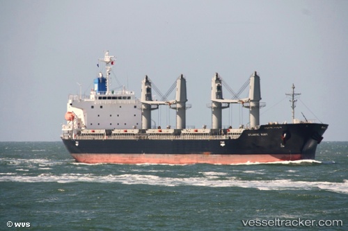
Vessel Atlantic Ruby IMO: 9628245, MMSI: 373320000 Bulk Carrier
UTC, 36.81041, 3.07573, course: 98, speed: 0
UTC, 36.81079, 3.07592, course: 113, speed: 0
2026-02-25 19:42:26 UTC, 36.81071, 3.07581, course: 105, speed: 0
Live AIS position:
UTC. Near Algiers),
updated 2026-02-25 19:42:26 UTC.
Find the position of the vessel Atlantic Ruby on the map. The latter are known coordinates and path.
marine traffic ship tracker show on live map
The current position of vessel Atlantic Ruby is 36.81071 lat / 3.07581 lng. Updated: 2026-02-25 19:42:26 UTCCurrently sailing under the flag of Panama
Atlantic Ruby built in 2012 year
Deadweight:
33680 tDetails:
Last coordinates of the vessel:
UTC, 36.80971, 3.07586, course: 69, speed: 0.1UTC, 36.81041, 3.07573, course: 98, speed: 0
UTC, 36.81079, 3.07592, course: 113, speed: 0
2026-02-25 19:42:26 UTC, 36.81071, 3.07581, course: 105, speed: 0