 vesseltracker.com
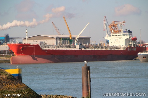
Vessel Fg Rotterdam IMO: 9485863, MMSI: 373474000 Chemical Oil Products Tanker
UTC, -17.46666, 59.40333, course: -1, speed: 12
UTC, -17.24910, 59.60005, course: 35, speed: 12.3
2026-02-01 08:16:27 UTC, -16.85521, 59.95183, course: 41, speed: 12.1
Live AIS position:
UTC. 231 nm NE of Cap Malheureux),
updated 2026-02-01 08:16:27 UTC.
Find the position of the vessel Fg Rotterdam on the map. The latter are known coordinates and path.
marine traffic ship tracker show on live map
The current position of vessel Fg Rotterdam is -16.85521 lat / 59.95183 lng. Updated: 2026-02-01 08:16:27 UTCDetails:
Last coordinates of the vessel:
UTC, -17.85729, 59.07633, course: 38, speed: 12.4UTC, -17.46666, 59.40333, course: -1, speed: 12
UTC, -17.24910, 59.60005, course: 35, speed: 12.3
2026-02-01 08:16:27 UTC, -16.85521, 59.95183, course: 41, speed: 12.1