 vesseltracker.com
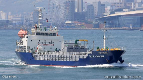
Vessel Blue Kingdom IMO: 9634828, MMSI: 373706000 Bitumen Tanker
UTC, 34.52087, 135.41554, course: 299, speed: 0
UTC, 34.52092, 135.41556, course: 299, speed: 0
2026-01-15 05:27:14 UTC, 34.52090, 135.41557, course: 299, speed: 0.1
Live AIS position:
UTC. Near Izumiotsu),
updated 2026-01-15 05:27:14 UTC.
Find the position of the vessel Blue Kingdom on the map. The latter are known coordinates and path.
marine traffic ship tracker show on live map
The current position of vessel Blue Kingdom is 34.52090 lat / 135.41557 lng. Updated: 2026-01-15 05:27:14 UTCDetails:
Last coordinates of the vessel:
UTC, 34.52092, 135.41554, course: 299, speed: 0.1UTC, 34.52087, 135.41554, course: 299, speed: 0
UTC, 34.52092, 135.41556, course: 299, speed: 0
2026-01-15 05:27:14 UTC, 34.52090, 135.41557, course: 299, speed: 0.1