 vesseltracker.com
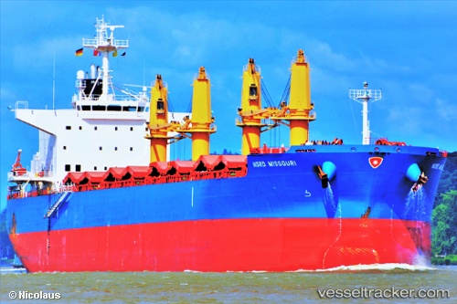
Vessel Nord Missouri IMO: 9725469, MMSI: 374171000 Bulk Carrier
UTC, -34.41723, 151.01859, course: 17, speed: 0.3
UTC, -34.41718, 151.01845, course: 22, speed: 0.3
2026-03-25 04:26:56 UTC, -34.41714, 151.01825, course: 30, speed: 0.3
Live Vessel Nord Missouri Analytics (details, animations, etc.)
Live AIS position: UTC. Near Cringila), updated 2026-03-25 04:26:56 UTC.Find the position of the vessel Nord Missouri on the map. The latter are known coordinates and path.
marine traffic ship tracker show on live map
The current position of vessel Nord Missouri is -34.41714 lat / 151.01825 lng. Updated: 2026-03-25 04:26:56 UTCNearest reference points:
- Near Sydenham
- Near Balmain
- Near DRUMMOYNE SYDNEY
Currently sailing under the flag of Panama
Details:
Last coordinates of the vessel:
UTC, -34.41731, 151.01891, course: 12, speed: 0.3UTC, -34.41723, 151.01859, course: 17, speed: 0.3
UTC, -34.41718, 151.01845, course: 22, speed: 0.3
2026-03-25 04:26:56 UTC, -34.41714, 151.01825, course: 30, speed: 0.3