 vesseltracker.com
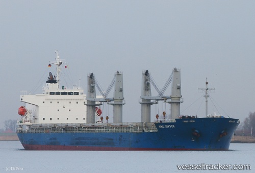
Vessel KING M IMO: 9614282, MMSI: 374560000 General Cargo Ship
UTC, 36.77755, 36.18948, course: 276, speed: 1.6
UTC, 36.77495, 36.12399, course: 260, speed: 0.2
2026-02-17 14:03:15 UTC, 36.77617, 36.12272, course: 235, speed: 0.7
Live AIS position:
UTC. Near DORTYOL),
updated 2026-02-17 14:03:15 UTC.
Find the position of the vessel KING M on the map. The latter are known coordinates and path.
marine traffic ship tracker show on live map
The current position of vessel KING M is 36.77617 lat / 36.12272 lng. Updated: 2026-02-17 14:03:15 UTCCurrently sailing under the flag of Panama
KING M built in 2012 year
Deadweight:
32809 tDetails:
Last coordinates of the vessel:
UTC, 36.78051, 36.19084, course: 78, speed: 0UTC, 36.77755, 36.18948, course: 276, speed: 1.6
UTC, 36.77495, 36.12399, course: 260, speed: 0.2
2026-02-17 14:03:15 UTC, 36.77617, 36.12272, course: 235, speed: 0.7