 vesseltracker.com
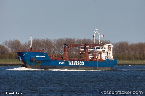
Vessel Murueta IMO: 9567269, MMSI: 374661000 General Cargo Ship
UTC, 30.46167, -79.41167, course: -1, speed: 9
UTC, 30.25833, -79.39167, course: -1, speed: 9
2026-01-19 08:35:21 UTC, 30.25833, -79.39167, course: -1, speed: 9
Live AIS position:
UTC. 102 nm NE of Flagler Beach),
updated 2026-01-19 08:35:21 UTC.
Find the position of the vessel Murueta on the map. The latter are known coordinates and path.
marine traffic ship tracker show on live map
The current position of vessel Murueta is 30.25833 lat / -79.39167 lng. Updated: 2026-01-19 08:35:21 UTCCurrently sailing under the flag of Panama
Murueta built in 2012 year
Deadweight:
7850 tDetails:
Last coordinates of the vessel:
UTC, 30.65167, -79.42667, course: -1, speed: 8UTC, 30.46167, -79.41167, course: -1, speed: 9
UTC, 30.25833, -79.39167, course: -1, speed: 9
2026-01-19 08:35:21 UTC, 30.25833, -79.39167, course: -1, speed: 9