 vesseltracker.com
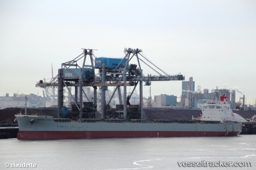
Vessel Primrose Atlantic IMO: 9544097, MMSI: 374907000 Bulk Carrier
UTC, 22.68137, 113.66416, course: 240, speed: 0
UTC, 22.68135, 113.66411, course: 240, speed: 0
2026-01-28 20:25:45 UTC, 22.68134, 113.66420, course: 240, speed: 0
Live AIS position:
UTC. Near Nansha),
updated 2026-01-28 20:25:45 UTC.
Find the position of the vessel Primrose Atlantic on the map. The latter are known coordinates and path.
marine traffic ship tracker show on live map
The current position of vessel Primrose Atlantic is 22.68134 lat / 113.66420 lng. Updated: 2026-01-28 20:25:45 UTCCurrently sailing under the flag of Panama
Details:
Last coordinates of the vessel:
UTC, 22.68126, 113.66417, course: 240, speed: 0UTC, 22.68137, 113.66416, course: 240, speed: 0
UTC, 22.68135, 113.66411, course: 240, speed: 0
2026-01-28 20:25:45 UTC, 22.68134, 113.66420, course: 240, speed: 0