 vesseltracker.com
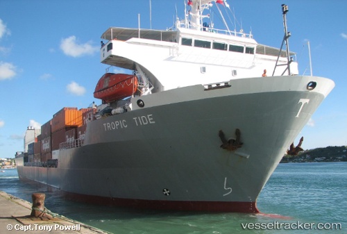
Vessel Tropic Tide IMO: 9039028, MMSI: 375903000 Ro Ro Cargo Ship
UTC, 26.25183, -78.81781, course: -1, speed: 13.5
UTC, 26.18402, -78.64537, course: 111, speed: 13.1
2026-03-02 04:58:58 UTC, 26.18402, -78.64537, course: 111, speed: 13.1
Live AIS position:
UTC. 20 nm S of Lucaya),
updated 2026-03-02 04:58:58 UTC.
Find the position of the vessel Tropic Tide on the map. The latter are known coordinates and path.
marine traffic ship tracker show on live map
The current position of vessel Tropic Tide is 26.18402 lat / -78.64537 lng. Updated: 2026-03-02 04:58:58 UTCCurrently sailing under the flag of St Vincent Grenadines
Tropic Tide built in 1993 year
Deadweight:
7430 tDetails:
Last coordinates of the vessel:
UTC, 26.40827, -79.17446, course: 117, speed: 13.1UTC, 26.25183, -78.81781, course: -1, speed: 13.5
UTC, 26.18402, -78.64537, course: 111, speed: 13.1
2026-03-02 04:58:58 UTC, 26.18402, -78.64537, course: 111, speed: 13.1