 vesseltracker.com
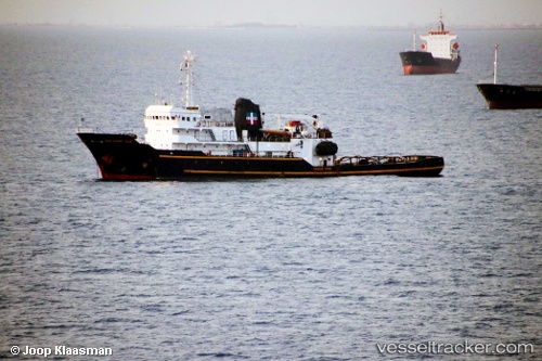
Vessel Salvage Ace IMO: 7626841, MMSI: 376513000 Tug
UTC, 35.06296, 129.05205, course: -1, speed: 0
UTC, 35.06296, 129.05205, course: -1, speed: 0
2026-01-20 02:34:00 UTC, 35.06297, 129.05206, course: -1, speed: 0.3
Live AIS position:
UTC. Near Busan),
updated 2026-01-20 02:34:00 UTC.
Find the position of the vessel Salvage Ace on the map. The latter are known coordinates and path.
marine traffic ship tracker show on live map
The current position of vessel Salvage Ace is 35.06297 lat / 129.05206 lng. Updated: 2026-01-20 02:34:00 UTCCurrently sailing under the flag of St Vincent Grenadines
Salvage Ace built in 1976 year
Deadweight:
1741 tDetails:
Last coordinates of the vessel:
UTC, 35.06297, 129.05219, course: -1, speed: 0.2UTC, 35.06296, 129.05205, course: -1, speed: 0
UTC, 35.06296, 129.05205, course: -1, speed: 0
2026-01-20 02:34:00 UTC, 35.06297, 129.05206, course: -1, speed: 0.3