 vesseltracker.com
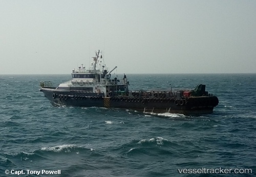
Vessel Stanford Maya IMO: 9613733, MMSI: 377693000 Service Ship
UTC, 25.07572, 53.26388, course: 157, speed: 0.5
UTC, 25.07587, 53.26389, course: 182, speed: 0.2
2026-01-28 09:38:49 UTC, 25.09971, 53.34997, course: 186, speed: 0.1
Live AIS position:
UTC. 17 nm E of Az Zarqa Island),
updated 2026-01-28 09:38:49 UTC.
Find the position of the vessel Stanford Maya on the map. The latter are known coordinates and path.
marine traffic ship tracker show on live map
The current position of vessel Stanford Maya is 25.09971 lat / 53.34997 lng. Updated: 2026-01-28 09:38:49 UTCDetails:
Last coordinates of the vessel:
UTC, 24.76967, 53.20777, course: 62, speed: 13.2UTC, 25.07572, 53.26388, course: 157, speed: 0.5
UTC, 25.07587, 53.26389, course: 182, speed: 0.2
2026-01-28 09:38:49 UTC, 25.09971, 53.34997, course: 186, speed: 0.1