 vesseltracker.com
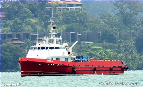
Vessel Karol W IMO: 9747455, MMSI: 377798000 Offshore Tug Supply Ship
UTC, -5.32815, 11.40641, course: 182, speed: 0.3
UTC, -5.32667, 11.40667, course: -1, speed: 0
2026-02-07 13:52:18 UTC, -5.32685, 11.40792, course: 196, speed: 0.3
Live AIS position:
UTC. Near Kuito Terminal),
updated 2026-02-07 13:52:18 UTC.
Find the position of the vessel Karol W on the map. The latter are known coordinates and path.
marine traffic ship tracker show on live map
The current position of vessel Karol W is -5.32685 lat / 11.40792 lng. Updated: 2026-02-07 13:52:18 UTCDetails:
Last coordinates of the vessel:
UTC, -5.32897, 11.40582, course: 134, speed: 0.2UTC, -5.32815, 11.40641, course: 182, speed: 0.3
UTC, -5.32667, 11.40667, course: -1, speed: 0
2026-02-07 13:52:18 UTC, -5.32685, 11.40792, course: 196, speed: 0.3