 vesseltracker.com
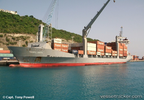
Vessel Tropic Unity IMO: 9225275, MMSI: 377913000 General Cargo Ship
UTC, 18.41366, -65.23534, course: 300, speed: 15.2
UTC, 18.80200, -65.85330, course: 300, speed: 15.1
2026-01-31 01:26:04 UTC, 18.95167, -66.08500, course: -1, speed: 15
Live AIS position:
UTC. 29 nm N of San Juan),
updated 2026-01-31 01:26:04 UTC.
Find the position of the vessel Tropic Unity on the map. The latter are known coordinates and path.
marine traffic ship tracker show on live map
The current position of vessel Tropic Unity is 18.95167 lat / -66.08500 lng. Updated: 2026-01-31 01:26:04 UTCCurrently sailing under the flag of St Vincent Grenadines
Tropic Unity built in 2002 year
Deadweight:
12418 tDetails:
Last coordinates of the vessel:
UTC, 18.33556, -64.94840, course: 259, speed: 0UTC, 18.41366, -65.23534, course: 300, speed: 15.2
UTC, 18.80200, -65.85330, course: 300, speed: 15.1
2026-01-31 01:26:04 UTC, 18.95167, -66.08500, course: -1, speed: 15