 vesseltracker.com
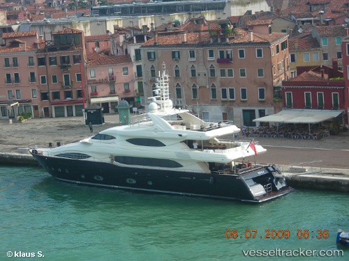
Vessel Sima IMO: 9400045, MMSI: 378259000 Service Ship
UTC, 43.64442, 10.35748, course: -1, speed: 0
UTC, 43.64443, 10.35745, course: -1, speed: 0
UTC, 43.64443, 10.35745, course: -1, speed: 0
2026-02-24 13:59:59 UTC, 43.64443, 10.35745, course: -1, speed: 0
Live AIS position:
UTC. Near Guasticce),
updated 2026-02-24 13:59:59 UTC.
Find the position of the vessel Sima on the map. The latter are known coordinates and path.
marine traffic ship tracker show on live map
The current position of vessel Sima is 43.64443 lat / 10.35745 lng. Updated: 2026-02-24 13:59:59 UTCCurrently sailing under the flag of British Virgin Is
Sima built in 2007 year
Deadweight:
33 tDetails:
Last coordinates of the vessel:
UTC, 43.64442, 10.35747, course: -1, speed: 0UTC, 43.64442, 10.35748, course: -1, speed: 0
UTC, 43.64443, 10.35745, course: -1, speed: 0
UTC, 43.64443, 10.35745, course: -1, speed: 0
2026-02-24 13:59:59 UTC, 43.64443, 10.35745, course: -1, speed: 0