 vesseltracker.com
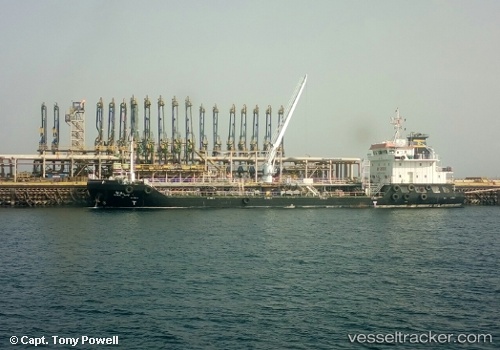
Vessel Dia IMO: 9619713, MMSI: 403519001 Oil Products Tanker
UTC, 26.62663, 50.26986, course: 136, speed: 0
UTC, 26.62683, 50.26996, course: 143, speed: 0
2026-02-03 09:53:09 UTC, 26.62677, 50.26998, course: 140, speed: 0
Live AIS position:
UTC. Near Ras Tannurah),
updated 2026-02-03 09:53:09 UTC.
Find the position of the vessel Dia on the map. The latter are known coordinates and path.
marine traffic ship tracker show on live map
The current position of vessel Dia is 26.62677 lat / 50.26998 lng. Updated: 2026-02-03 09:53:09 UTCDetails:
Last coordinates of the vessel:
UTC, 26.62647, 50.26980, course: 129, speed: 0UTC, 26.62663, 50.26986, course: 136, speed: 0
UTC, 26.62683, 50.26996, course: 143, speed: 0
2026-02-03 09:53:09 UTC, 26.62677, 50.26998, course: 140, speed: 0