 vesseltracker.com
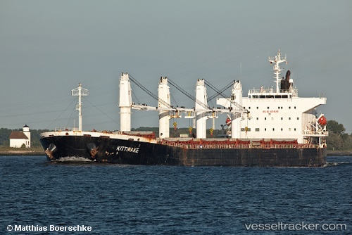
Vessel GRAND ROYAL EXPRESS IMO: 9254549, MMSI: 405000263 Bulk Carrier
UTC, 22.21939, 91.74826, course: 337, speed: 0
UTC, 22.21944, 91.74834, course: 347, speed: 0
2026-02-22 17:50:02 UTC, 22.22332, 91.74709, course: 156, speed: 0
Live AIS position:
UTC. Near Chittagong),
updated 2026-02-22 17:50:02 UTC.
Find the position of the vessel GRAND ROYAL EXPRESS on the map. The latter are known coordinates and path.
marine traffic ship tracker show on live map
The current position of vessel GRAND ROYAL EXPRESS is 22.22332 lat / 91.74709 lng. Updated: 2026-02-22 17:50:02 UTCCurrently sailing under the flag of Bangladesh
GRAND ROYAL EXPRESS built in 2002 year
Deadweight:
53146 tDetails:
Last coordinates of the vessel:
UTC, 22.21939, 91.74834, course: 333, speed: 0UTC, 22.21939, 91.74826, course: 337, speed: 0
UTC, 22.21944, 91.74834, course: 347, speed: 0
2026-02-22 17:50:02 UTC, 22.22332, 91.74709, course: 156, speed: 0