 vesseltracker.com
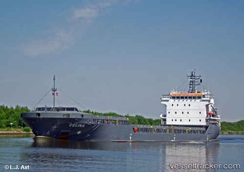
Vessel Celina IMO: 9306378, MMSI: 408543000 General Cargo Ship
UTC, 26.60809, 50.27062, course: -1, speed: 0.2
UTC, 26.60811, 50.27061, course: -1, speed: 0.1
2026-03-04 19:42:24 UTC, 26.59100, 50.22406, course: -1, speed: 6.8
Live Vessel Celina Analytics (details, animations, etc.)
Live AIS position: UTC. Near Ad Dammam), updated 2026-03-04 19:42:24 UTC.Find the position of the vessel Celina on the map. The latter are known coordinates and path.
marine traffic ship tracker show on live map
The current position of vessel Celina is 26.59100 lat / 50.22406 lng. Updated: 2026-03-04 19:42:24 UTCDetails:
Last coordinates of the vessel:
UTC, 26.60825, 50.27091, course: -1, speed: 0.4UTC, 26.60809, 50.27062, course: -1, speed: 0.2
UTC, 26.60811, 50.27061, course: -1, speed: 0.1
2026-03-04 19:42:24 UTC, 26.59100, 50.22406, course: -1, speed: 6.8