 vesseltracker.com
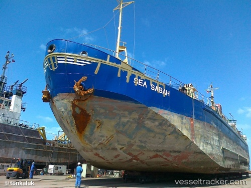
Vessel Sea Sabah IMO: 7000293, MMSI: 408588000 General Cargo Ship
UTC, 26.18970, 50.73864, course: 2, speed: 0
UTC, 26.18968, 50.73855, course: 2, speed: 0.1
2026-03-04 11:33:28 UTC, 26.18964, 50.73831, course: 20, speed: 0.1
Live Vessel Sea Sabah Analytics (details, animations, etc.)
Live AIS position: UTC. Near KHALIFA BIN SALMAN), updated 2026-03-04 11:33:28 UTC.Find the position of the vessel Sea Sabah on the map. The latter are known coordinates and path.
marine traffic ship tracker show on live map
The current position of vessel Sea Sabah is 26.18964 lat / 50.73831 lng. Updated: 2026-03-04 11:33:28 UTCDetails:
Last coordinates of the vessel:
UTC, 26.18992, 50.73889, course: -1, speed: 0.2UTC, 26.18970, 50.73864, course: 2, speed: 0
UTC, 26.18968, 50.73855, course: 2, speed: 0.1
2026-03-04 11:33:28 UTC, 26.18964, 50.73831, course: 20, speed: 0.1