 vesseltracker.com
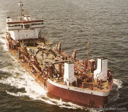
Vessel SUGAR ISLAND IMO: 7807720, MMSI: 408954000 Hopper Dredger
UTC, 26.32699, 50.71633, course: -1, speed: 1.8
UTC, 26.32699, 50.71633, course: -1, speed: 1.8
2026-02-28 08:13:25 UTC, 26.32699, 50.71633, course: -1, speed: 1.8
Live Vessel SUGAR ISLAND Analytics (details, animations, etc.)
Live AIS position: UTC. Near Bahrain International Airport), updated 2026-02-28 08:13:25 UTC.Find the position of the vessel SUGAR ISLAND on the map. The latter are known coordinates and path.
marine traffic ship tracker show on live map
The current position of vessel SUGAR ISLAND is 26.32699 lat / 50.71633 lng. Updated: 2026-02-28 08:13:25 UTCCurrently sailing under the flag of Bahrain
SUGAR ISLAND built in 1979 year
Deadweight:
4357 tDetails:
Last coordinates of the vessel:
UTC, 26.32699, 50.71633, course: -1, speed: 1.8UTC, 26.32699, 50.71633, course: -1, speed: 1.8
UTC, 26.32699, 50.71633, course: -1, speed: 1.8
2026-02-28 08:13:25 UTC, 26.32699, 50.71633, course: -1, speed: 1.8