 vesseltracker.com
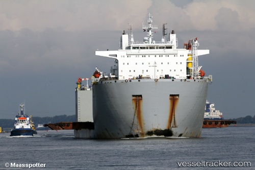
Vessel Hua Hai Long IMO: 9560144, MMSI: 412036000 Heavy Load Carrier
UTC, 1.25423, 103.88769, course: 31, speed: 0.1
UTC, 1.25443, 103.88810, course: 264, speed: 0.1
2026-01-30 03:36:18 UTC, 1.21555, 103.86242, course: 237, speed: 7
Live AIS position:
UTC. Near Singapore),
updated 2026-01-30 03:36:18 UTC.
Find the position of the vessel Hua Hai Long on the map. The latter are known coordinates and path.
marine traffic ship tracker show on live map
The current position of vessel Hua Hai Long is 1.21555 lat / 103.86242 lng. Updated: 2026-01-30 03:36:18 UTCCurrently sailing under the flag of China
Hua Hai Long built in 2012 year
Deadweight:
30002 tDetails:
Last coordinates of the vessel:
UTC, 1.25411, 103.88787, course: 42, speed: 0UTC, 1.25423, 103.88769, course: 31, speed: 0.1
UTC, 1.25443, 103.88810, course: 264, speed: 0.1
2026-01-30 03:36:18 UTC, 1.21555, 103.86242, course: 237, speed: 7