 vesseltracker.com
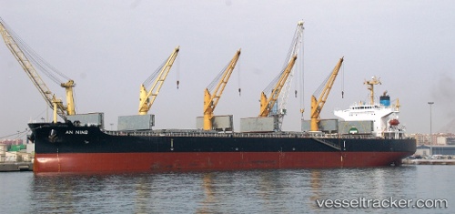
Vessel 'XIN AN NING' IMO: 9407859, MMSI: 412345000
UTC, 29.95007, -90.30439, course: 223, speed: 6.9
UTC, 30.04540, -90.59607, course: 236, speed: 12.6
2026-01-28 14:08:40 UTC, 30.11423, -90.91558, course: 347, speed: 7.1
Live AIS position:
UTC. Near Burnside),
updated 2026-01-28 14:08:40 UTC.
Find the position of the vessel 'XIN AN NING' on the map. The latter are known coordinates and path.
marine traffic ship tracker show on live map
The current position of vessel 'XIN AN NING' is 30.11423 lat / -90.91558 lng. Updated: 2026-01-28 14:08:40 UTCDetails:
Last coordinates of the vessel:
UTC, 29.95601, -90.30076, course: 225, speed: 0UTC, 29.95007, -90.30439, course: 223, speed: 6.9
UTC, 30.04540, -90.59607, course: 236, speed: 12.6
2026-01-28 14:08:40 UTC, 30.11423, -90.91558, course: 347, speed: 7.1